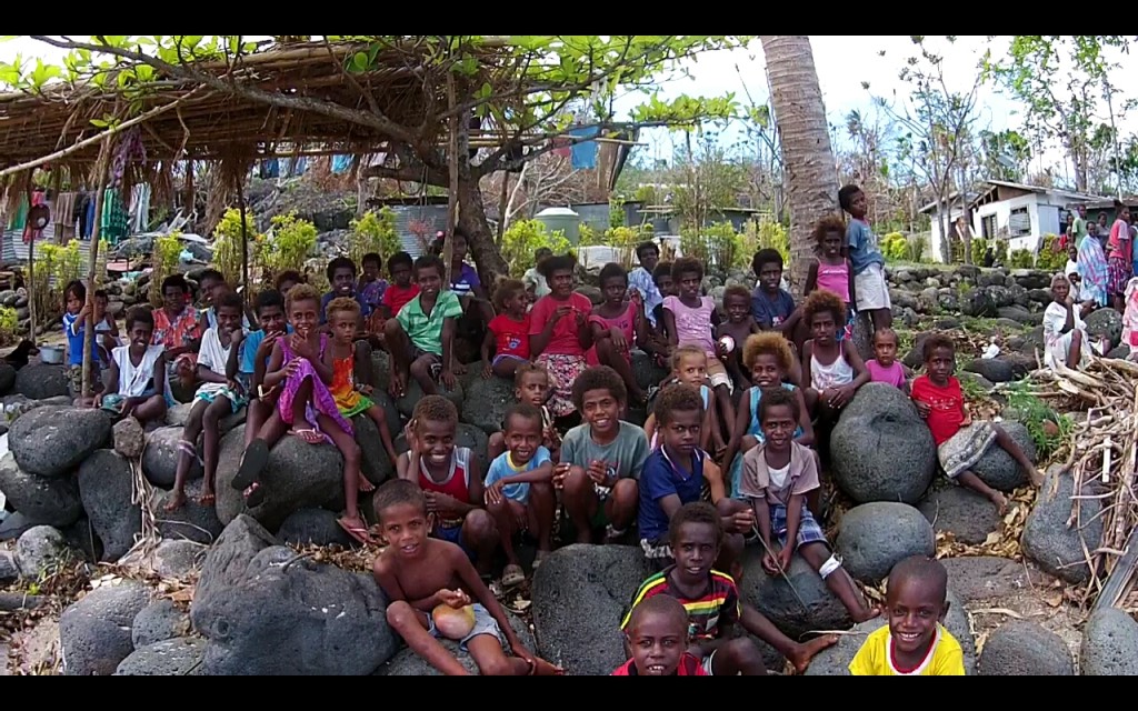
You’ve heard that Cyclone Pam has had a devastating effect on Vanuatu but let me try to put the intensity of this storm into perspective. Firstly, this cyclone was a category 5. Cyclone Tracy which destroyed Darwin in 1974 was a category 3 cyclone. The sustained wind speeds of cyclone Pam were over 250 kilometers per hour (kph) with gusts over 320 kph. Winds at this speed wouldn’t just blow you off your feet – they are strong enough to lift you vertically at over 120 kph! It’s amazing that anyone survived this.
Imagine that you are sheltering from this storm in your own house, as your it is struck with sand, rocks, dust, branches and debris flying at those speeds, in pitch black, in the middle of the night. The locals said the worst thing was the sound. Not only was it as deafening as a jet engine but the pressure changes and “warbles” were unbearable yet went on for hours and hours. Ok, now imagine that you aren’t sheltering in your house but in a thatch hut in the jungle. Oh, and when the storm surge comes rushing in you have to hold your precious children over your head so they didn’t drown.
After it had passed and the morning light broke you would see that not only has your house and all your possessions literally been blown away but the rest of the village has to. Children have no schools to go to. Fruit trees and the crops are gone. Your beautiful “Avatar” forest no longer has leaves. Many of the massive trees are uprooted and coconut palms snapped off half way up. Despite all this, the Vanuatu people are unbelievably resilient and still wearing their famous Vanuatu Smiles. They have started to clean up, clear the roads of debris and rebuild but they need our help.
After such a disaster it is paramount to act quickly to assess the damage to ensure that help gets to those that need it most. Information is key but how do you gather this information when communication systems are down? This is where we come in using drones.
We are using multi-rotor drones to capture high resolution aerial photos, low level video, and low level oblique photos. Oblique photos are taken taken on a slight angle, rather than straight down, to provide perspective to the damage. This combination of image types provides a powerful tool set that can be used by a range of assessment teams now and into the future. All of the information is stored on the local Vanuatu Government GIS database and also sent up to cloud services such as the NGIS Cyclone Pam Crisis Map and MicroMappers. These tools are used by United Nations staff around the globe to ensure aid reaches the people on the ground.
Why drones? In many areas the satellite resolution isn’t detailed enough to show actual damage and often cloud cover obscures the images. Traditional aircraft, if available, can’t fly as low or as slow as the drones which can reduce the image quality and the amount of information that can be gathered from the images. Our approach has been to get to the villages by “any means possible” and to capture the images and video, process it in the field, then to deliver it to the Vanuatu GIS team for upload. Our drones pack really small and are light which has enabled us to take them on what ever transport has become available. So far this has included planes, boats, taxis, and even motorbikes to get to the hard to reach places. Tomorrow we depart for the Shepard Island group in the north of Vanuatu on another helicopter to island hop and map as we go. By far this drone-and-helicopter combination has turned out to be the most rapid way to capture the imagery and get it back in time.
This is an amazing multi-national collaborative effort. I’m here as part of the Western Australian HeliWest UAV team working with the Vanuatu Government (Vanuatu Ministry of Lands and Natural Resources), the Pacific Island National Disaster Management Office coordinators from Fiji, the X-Craft crew from New Zealand, the Digital Humanitarian Network, the UN and the World Bank.
The Vanuatu people have been amazingly helpful to us, and thanks to the “talk savy” radio program, they have been expecting us. The kids are told “no elastic” which means not to shoot down our drones with their slingshots! They are all great shots so we wouldn’t get too far without their cooperation. They get so excited when we come to their village and show them the drones. It does get hard sometimes piloting the drones when you have kids clamboring on you to see the live video on the display but I don’t blame them as I would too! The adults are just as excited as the kids so they come to look what the kids are making all this noise about. Many kids follow the drones as they fly from side to side as they map the damage to the village. The kids get given important jobs like keeping the dogs from attacking the drones during takeoff and landings and pointing out where the drones are when we pretend to lose sight of them. I have to admit it has been an incredible adventure so far and a pleasure to do this ground breaking work.
The great news is that the aid is getting delivered and the locals are rebuilding, but, they still need all the help you can spare so please donate and help these wonderful people get back on their feet!


